This website requires certain cookies to work and uses other cookies to help you have the best experience. By visiting this website, certain cookies have already been set, which you may delete and block. By closing this message or continuing to use our site, you agree to the use of cookies. Visit our updated privacy and cookie policy to learn more.
This Website Uses Cookies By closing this message or continuing to use our site, you agree to our cookie policy. Learn MoreThis website requires certain cookies to work and uses other cookies to help you have the best experience. By visiting this website, certain cookies have already been set, which you may delete and block. By closing this message or continuing to use our site, you agree to the use of cookies. Visit our updated privacy and cookie policy to learn more.
Nicholas Weil has made it a goal of his to seek continual growth both personally and professionally. Luckily for him, the ever-changing geospatial industry provides ample opportunity for his life-long pursuit of knowledge.
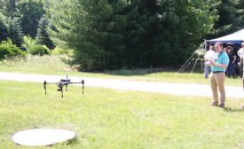
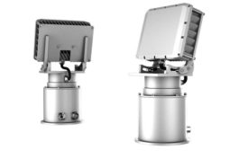
UAV safety is the largest technical and regulatory barrier that drone manufacturers and technology providers must overcome in order to accelerate this flourishing new industry, in which radar plays a major role.
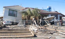
Natural disasters often result in the loss of valuable cultural resources; detailed surveys completed beforehand provide accurate data to support research and rebuilding efforts.
For companies that want real-time intelligence, analytics are invaluable. And the geospatial information realm is no different. So, what should companies do now?
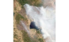
Remote sensing products and services accelerate response time, deliver more actionable information into the hands of first responders, and help rebuilding efforts during and after natural and man-made disasters.
David Sandilands is an aerial survey pilot and remote sensing technician with The Barbara Wheatland Geospatial Analysis Laboratory – School of Forest Resources, at the University of Maine in Orono, Maine.