POBOnline
  Home


  eNews Archive
  Subscription Customer Service
  Online Updates
  Latest News
  Calendar of Events
  Call for Papers
  Webinars
  Fun + Games
  New Products
  Surveying in the Headlines
  Top RPLS Bulletin Board Posts
  Current Issue
  Cover Story
  Features
  Columns
  Resources
  Archives
  Classified Ads
  Classified Listings
  Digital Edition Archives
  Distance Education
  Geo Locator Buyers Guide
  Industry Links
  Information Showcase
  
  
  Product Showrooms
  Product Surveys
  POB Info
  Special Collections
  GIAA Mailbag/Tool Tips
  GPS Observer Series
  Site Prep
  Surveying GIS
  Surveyor + the Law
Search in: EditorialProductsCompanies

To have your product included in our listings, please send details to Associate Editor Wendy Lyons at .

NEW Products

Applanix Introduces the POSTrack 410 Flight Management and Direct Georeferencing System

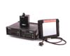
The POSTrack™ 410 Flight Management and Direct Georeferencing system from Applanix is designed specifically to be used with the latest generation of medium-format airborne digital photogrammetric cameras to maximize the efficiency and productivity of airborne mapping.


U-Mark Introduces the AP-1 Greenlabel Ink Marker

Providing up to 12 times the writing mileage of ordinary permanent markers, AP-1’s Advanced Valve Technology ensures the ink is used to the last drop.


Topcon GRS-1 and GeoAge FASTXchange

The Topcon GRS-1 features a dual-frequency GNSS receiver, Windows Mobile 6.1 operating system, high-speed processor, digital camera and integrated cellular modem.


Bentley Systems, Inc. Announces the Release of ProjectWise Dynamic Plot V8i

Using the advanced publishing capabilities of ProjectWise InterPlot, the new software adds a unique pattern of dots to a drawing as it is plotted.


ASPRS Publishes New GIS Manual

ASPRS will release its "Manual of Geographic Information Systems" in July 2009. This book is designed to be a comprehensive resource on GIS for students, researchers and practioners who are interested in asking spatial questions, assessing landscapes, building geodatabases and envisioning a world of integrated geospatial technologies.


BNP Media
© 2009 . All rights reserved. |