Design Software for Sustainable Neighborhoods - June 11, 2009 PPS is the first software driven system that empowers the neighborhood planner to design full color beautiful neighborhood plans that can hasten approvals, with green (sustainability) data analysis and engineering accuracy.
Manual of Geographic Information Systems Published by ASPRS - June 10, 2009 This volume is designed to be a comprehensive resource on GIS for students, researchers and practioners who are interested in asking spatial questions, assessing landscapes and more.
Recent news reports indicate that the economy might finally be turning the corner. Is this just a blip on the radar, or is a substantial recovery under way?
Users give a general idea of the type of solution they need. However, their responses, as anyone else’s, are based on their beliefs, experiences, areas of expertise and personal agendas. It is therefore important to direct user responses toward the data by asking the correct questions
by DarronPustam, MBA, GISP | June 10, 2009 | Comments (0)
Geo Locator
The #1 buyers’ guide for land surveyors and geomatics professionals. Search listings for software and equipment manufacturers, equipment dealers and professional services.
Highlights in Surveying
Back for a fifth year, Highlights in Surveying recognizes great surveys around the world. We've completely revamped the competition format this year to make it even easier for you to enter and increase your odds of winning. Click the logo to enter.
Fun & Games
Learn a new joke to share with your colleagues, test your knowledge with a survey problem, and we even give you a link to a cool new website to check out. Updated weekly!
Auburn University
Convenient and reasonably priced, Auburn University’s video, DVD, and web-based courses are a great resource for you to earn your state’s required continuing education credits.
POB’s bi-weekly eNews brings the latest news, product updates and industry information right to your mailbox. Stay informed and sign up today!
Shop at BNP Media’s AEC Store for unique surveying gifts including a working, half-scale Rittenhouse Compass, impressive surveyor statues, compass medallions and more.
Connect with Point of Beginning NOW:
Interested in FREE MAGAZINES? Start your subscription to any BNP publication by clicking here.
Survey before you buy property HeraldNet: Question: Over a year ago, I purchased a piece of property listed at 5.5 acres. The legal description has no measurements and says basically, this property lies from the road to the section line. ...
Historical society learns about surveying in the early days of the county Emery County Progress: Ben Grimes set up a slide presentation in the Courthouse Canyon room about A. D. Ferron. Grimes lives in Elmo. He said that, "He is a newcomer though, because he has only lived in Elmo 36 years." Grimes is a professional land surveyor and works currently for Carbon County as a surveyor.
Big Land Dispute in Winona County ABC 6 NEWS (kaaltv.com) -- It's a border battle that's been going on for years. Back in 1975 Winona County made major errors when drawing property lines.
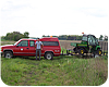
Web Exclusive: My Survey Truck I've noticed that, like each survey plat we produce, each surveyor has a unique way of setting up his or her own survey truck. So, for the last couple of years, it's been a vision of mine to create a platform where we surveyors can show off our survey vehicles—all in the interest of having some competitive fun, of course. ...
by Joseph D. FeniclePS
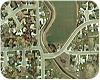
Full Enclosure Water has always been an important resource for Utah County. Located south of Salt Lake City, near Utah Lake, the region was once dominated by agriculture. As early as 1865, groups of farmers and private investors began forming the first irrigation districts to harness water from the Provo, Weber and Duchesne rivers and convey it through canals to the fertile farmland in the valley and outlying areas. ...
This handbook provides guidance for land surveyors who are interested in starting or improving their own business. Veteran surveyor Dan Beardslee provides valuable insight and information with real-life examples from his classroom and field experience. He provides 21 business management rules for land surveyors to follow as well a number of sample financial statements and worksheets.
Capitol Gains: Defining your business. Have you ever gone to the bank for a loan and been asked for your business plan? Have you ever struggled when attempting to tell the bank what your firm’s market share is?
by John M.Palatiello
Safety Sense: Field vehicle safety. If you have to drive to a jobsite, the best way to start a safe day’s work is to make sure your vehicle is in good condition and has the proper equipment and storage.
by Ronald E.Koons
From the Ground Up: Capturing the tides. A few years ago, it was fairly uncommon for me to undertake projects with a requirement for tide- coordinated acquisition. This situation has changed.


 The #1 buyers’ guide for land surveyors and geomatics professionals. Search listings for software and equipment manufacturers, equipment dealers and professional services.
 Learn a new joke to share with your colleagues, test your knowledge with a survey problem, and we even give you a link to a cool new website to check out. Updated weekly!
 Convenient and reasonably priced, Auburn University’s video, DVD, and web-based courses are a great resource for you to earn your state’s required continuing education credits.
 POB’s bi-weekly eNews brings the latest news, product updates and industry information right to your mailbox. Stay informed and sign up today!